
Do you know there is a new version of CARIS Onboard? Version 2.0 with build in leaflet maps and improved interface?
With VPN use – you can manage whole process of data collection fully remotely!
Probably you have noticed last time some rumours that CARIS introduced a new software – CARIS Onboard.
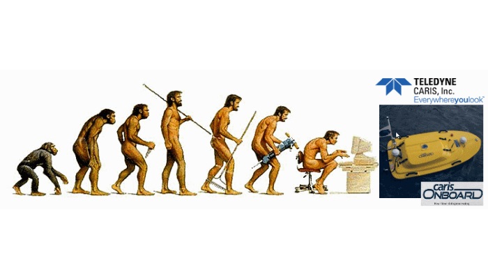
This software seems to be next step in survey evolution – I would say it is. That why I have used popular on Internet image showing human evolution…
And this is a natural step – no mutations – just a software which is directly using what was and is the best in CARIS processing line!
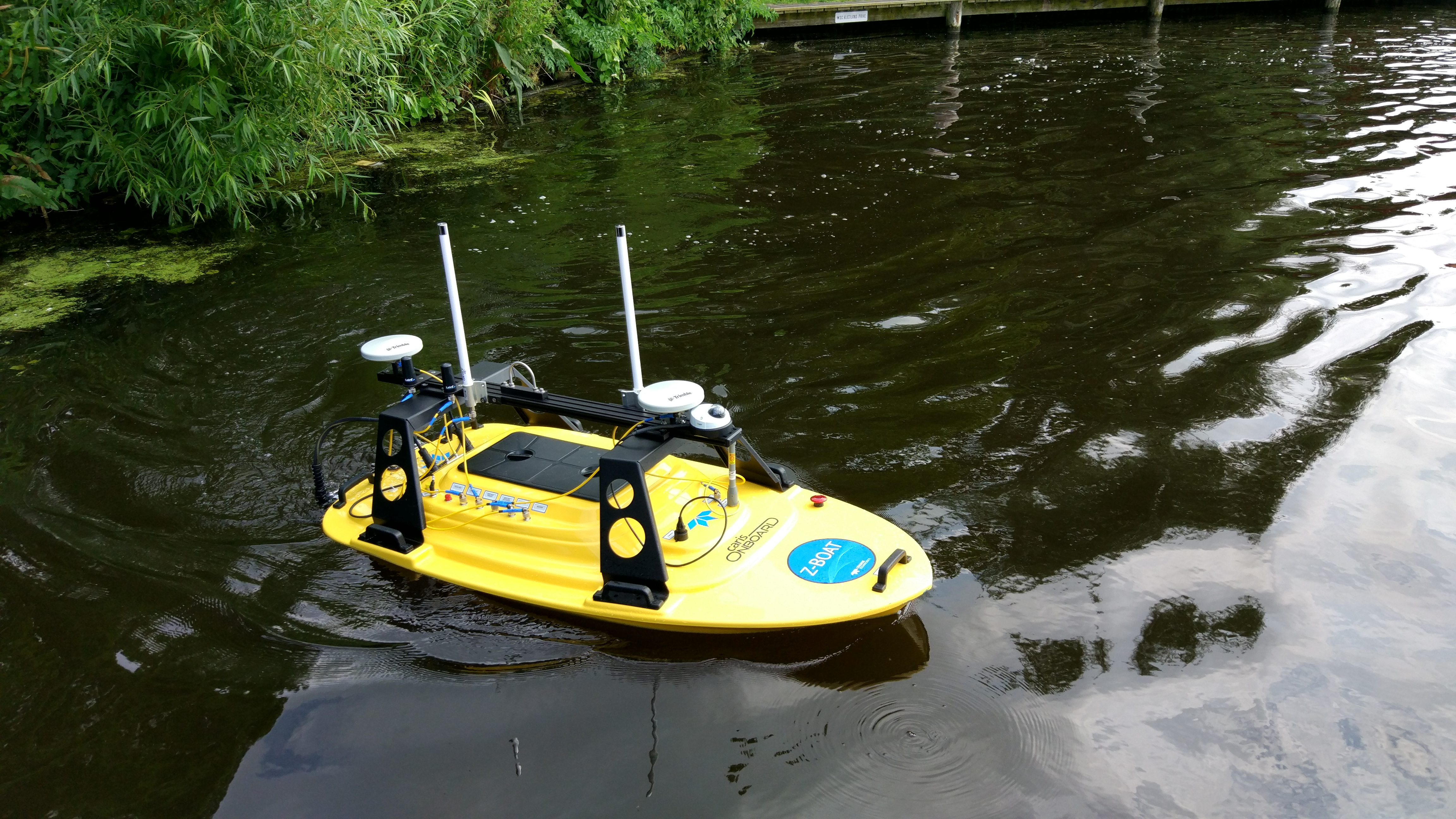
More – this is not only for big companies and market leaders – it is actually very beneficial solution as well for very small companies which have one or two vessels – or for start-ups (if I would start now I would never buy big survey vessel – for ports, offshore and inland waters – I would design small boat 2-3m long with electric engine and some electronic stuff for remote controlling and small survey system like Reson P series or Kongsberg 2040 Compact or any other small in size and very efficient – just OT – so no man on board…. just technique which is available now on market. And you would save a lot of money! Think about that.) . Question is if you understand why…
So in this short post, I want to bring a little closer what Onboard can do for you – if you are big or small company…..
What is CARIS Onboard system
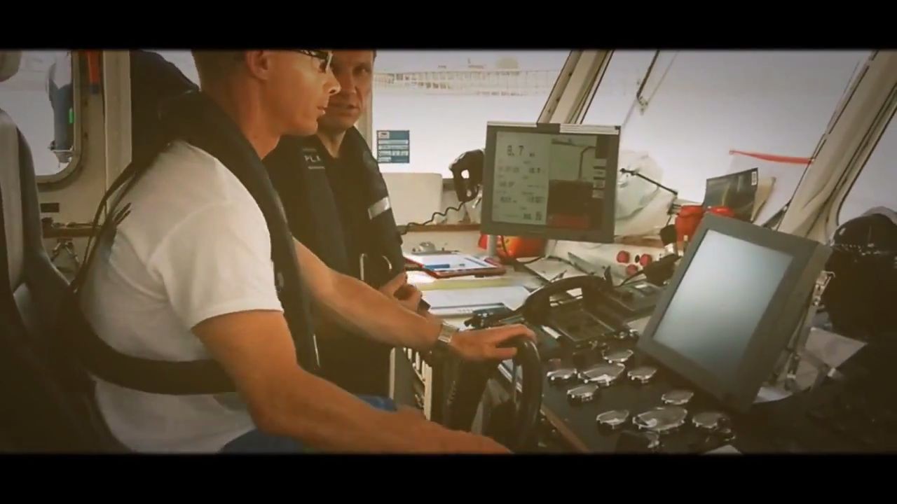
In short – it is a system for automated Onboard data processing (more on CARIS product site). So you have a vessel (or remote operating boat). On that vessel, you have MBES or Interferometric system, GPS, MRU etc… Normally it should be calibrated. If it is integrated system – like mentioned small electric boat – it is normally fully integrated and calibrated at once. You normally know what you want to do to your data. What you plan to apply. Maybe you do not have a real tide… this could be the one missed element. But you have your GPS Heights or predicted tide (or just ZERO tide for temporary use). Onboard is allowing you to set up full processing steps and apply those in real time – just during the survey. So you really see what you are doing and how data are looking – you focus on detection and Quality Control. And it can work with most every echosounder on market today!
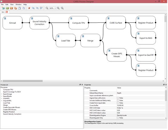
Just above how you set up processing steps. This is what you are going to apply to your data. What does it mean for you? Time for processing is limited!!! You are getting directly processed data. You focus on QC. And you do not need to be on vessel!!!! You are just sitting at home or in office and you control everything remotely. Through the web or Remote Desktop. YES – the system is displaying everything through web interface! Plus using free CARIS software.
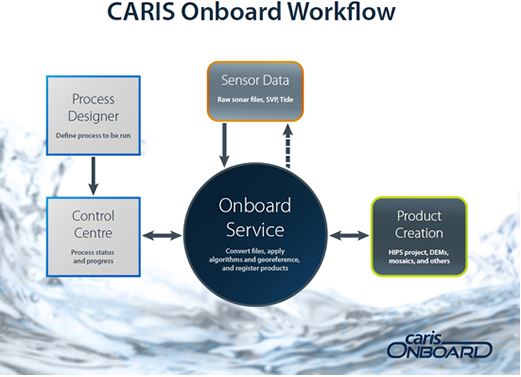
So your workflow looks like this…. just a small revolution…
All is controlled remotely and at any moment you can go and if needed change parameters and change the way how the data are collected. And in real time you can grab the data from the system and send a preview to your client – as BAG file or GeoTIFF or in CSAR format. Or you can show directly the progress of the survey.
Ahhhh – it is for big companies… Really? Not really…
It is not a very expensive and fancy solution. It is, to be honest a very easy and cheap solution. Just use the technology which is around you….
What you need….
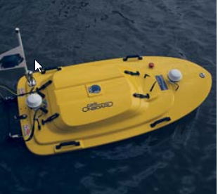
- A boat with equipment – probably you have that one…. It could be the same like this:
- Another boat…. if you are bigger…. and another…. and another…..
- One person to control remotely boat no 1 and boat no 2 and….. do not put too much on one person, please… I can control in one time normally 3 systems (it is a good result – I’m a man – I think women are better in this… 😉 – sorry guys…)
- 3G or 4G GSM modem on every boat. If you survey close to the GSM network (up to 15-20km) – or other broadband data connection.
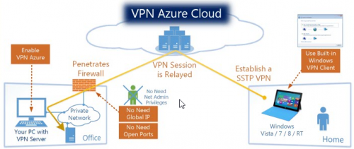
- VPN connection to the boat – please – see how to set up this on that page – it costs nothing and it would work with any GSM modem (and you can use that as well for home)!!! Never use direct port redirection to your system… that is really unsafe!
- You have your system prepared for the survey – survey planned and system configured.
- You have CARIS Onboard and you know what to apply to your data. So you build processing steps there… (ask CARIS for a demo!).
- You have a comfortable chair at home or office and nice computer with a few screens… and you are connected at home as well to the Internet.
- That’s it… you are ready.
So you start your survey and … just connect to the VPN to the vessel no 1…. no 2… and open website http://192.168.25.23:8080 (IP is fake – it should be IP which is on the Onboard system – I would suggest using on every boat a different subnet like 192.168.10.x on boat 1, 192.168.11.x on boat 2 etc…) and you are ready to control progress.
Additionally you can use CARIS EasyView (free from our site) to display surface in real time – processed surface – with all extra layers for CUBE like Hypothesis Count and Hypothesis Strength – as well Density etc… so you have everything to control progress and Quality – and if something is wrong – you do not lose money to re-survey the area later in time.
Plus more – using RDP (standard Remote Desktop) you can log in to the computer on your vessel and rebuild processing steps (network license is needed) or start HIPS and do something more…. or you can upload or download the data directly.
Benefits?
Yes – I think you see now a little better what are the benefits.
- One processor or hydrographer can control the progress of the survey on more than just one vessel.
- In any moment you can access your systems remotely and modify settings. You can even stop the survey and modify parameters of MBES and apply those remotely.
- You have no sea sickness… as you are sitting at home or at the office and normally in office everything is stable 😉
- Generally – you can save a lot of money planing new equipment – as you do not need big boat any-more, you can use small automated boats. Or you can develop your own small boat equipped with remote sensing equipment, extra cameras etc. and small long-lasting batteries (you can build your own small water “Tesla” car).
- And you save a lot of time for data processing – doing everything in one package and in one line of software from CARIS. Without any pop-up windows, switching between different windows, applications… all in one place.
So workflow looks like natural step in processing evolution – MBES with MBES software to collect the data -> CARIS Onboard -> optionally CARIS HIPS for finalising -> (optionally CARIS Spatial Fusion to share your products through web interface – in almost real time – just look at UKHO Share system) -> CARIS BASE Editor and Manager to create vector products and to store and manage data -> CARIS Chart production line to produce your final product.
It is looking really natural – and if you know HIPS you should have no big problems to enjoy our other products…. All our products use similar philosophy in design and development.